
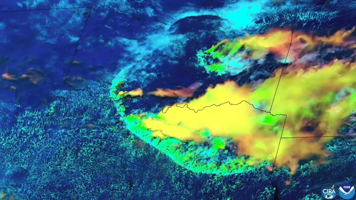
The footage shows a weakening storm on the Texas-Oklahoma border, from which an arc-shaped wave began to spread. Here it creates colder and denser air, which descends to the earth’s surface during the life of the storm. After reaching it, it spills to the sides, similar to water after being poured from a container.
It is this boundary, referred to by meteorologists as the gust front or outflow boundary, that can be significant for the further development of the weather. It often works similarly to a smaller cold front and supports the formation of new showers or thunderstorms tens of kilometers from the original storm core. This process is also clearly visible on satellite images.
The phenomenon itself is not rare and is accompanied by many stronger storms during the summer months. However, the extent and expressiveness of this gust queue and the quality of the shots, on which the whole process is extremely well visible, are exceptional.
We also encounter a similar phenomenon in Central Europe, including the Czech Republic. At meteorological stations, its transition is often manifested by a sudden increase in wind, a change in its direction and a drop in temperature by several degrees Celsius even before the precipitation itself.
