
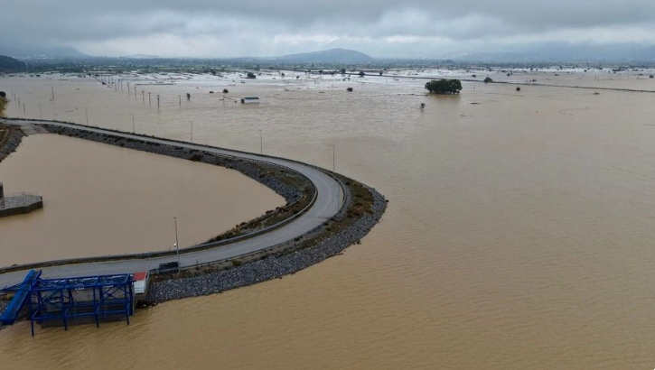
As the bad weather gradually recedes, the full extent of the damage caused by heavy rain and flooding is being revealed on the Greek island of Crete.
Entire streets have been damaged or turned into piles of rubble, while in some areas water and mud have infiltrated homes. Serious problems have also been reported in water supply networks, while thousands of hectares of agricultural land have ended up under water.
Teams of engineers from the Directorate for the Rehabilitation of the Consequences of Natural Disasters will carry out checks on buildings and infrastructures.
The first phase of inspections will include the villages of Zoniana, Livadia, Veni and Axos, which are considered among the areas most affected by extreme weather.
The controls aim to determine the damage to housing, public buildings, roads and infrastructure networks, creating a complete overview of the needs for intervention and reconstruction.
An extended government delegation is also expected to arrive in Crete, which will closely inspect the most damaged areas.
A meeting with the responsible institutions and representatives of the local government will take place at the headquarters of the Region of Crete. The focus will be on assessing the situation, recording damages and coordinating measures to deal with the consequences of bad weather.
In order to more accurately determine the size of the affected areas, the European Copernicus mechanism has also been activated.
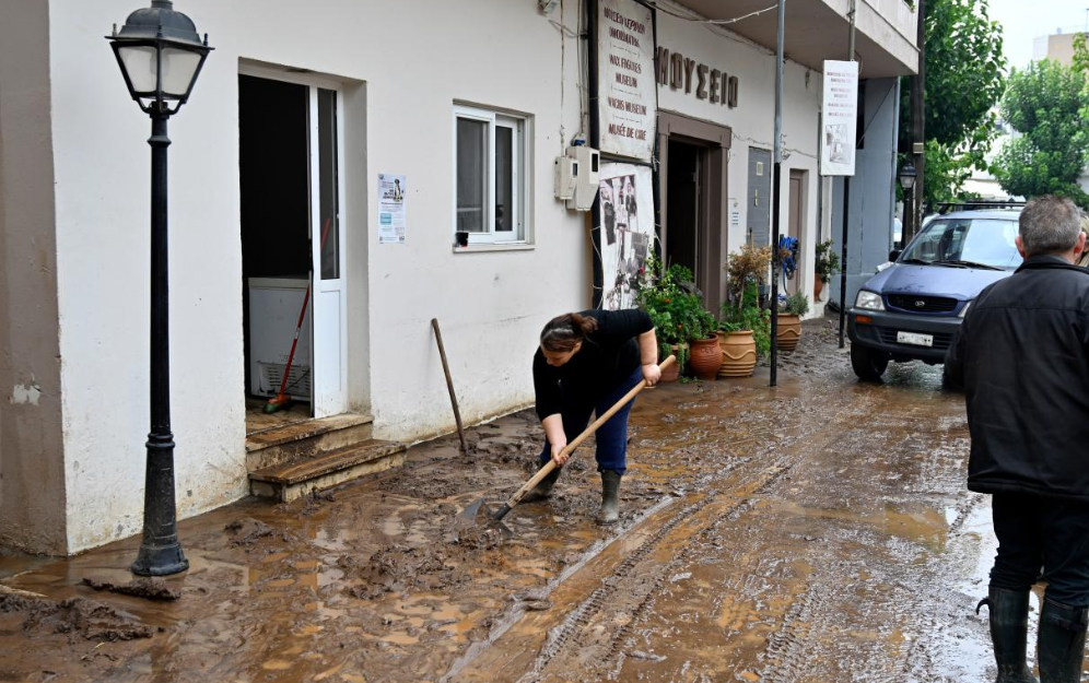
According to the Ministry of Climate Crisis and Civil Protection, the Copernicus Emergency Management Service – Mapping has been activated. Satellite data and maps are expected to help authorities determine flooded areas and assess the extent of damage.
The consequences of bad weather have also affected education. In the municipality of Mylopotamos, primary and secondary schools, as well as nurseries and kindergartens in the Kouloukonas unit, will remain closed on Monday and Tuesday.
The decision was made due to access difficulties and problems created in water supply networks.
Over 800 millimeters of rain – 18 thousand hectares under water
The first data indicate extremely intense rainfall.
More than 800 millimeters of rain have been recorded in Xyloskalo, while large amounts of water have also fallen in other areas of Crete. The situation is particularly dire in the Plateau of Lasithi, where more than 18,000 hectares of land have been flooded.
The floods have caused significant damage to the agricultural sector. According to the first estimates, it will take several days for the water to recede so that farmers can enter their plots and assess the damage.
Cracked roads and destroyed infrastructure
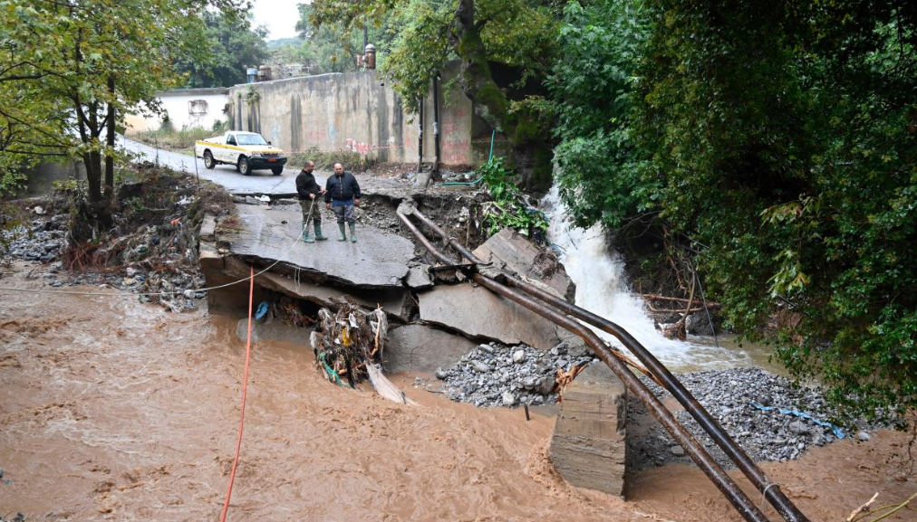
Great damage was also recorded in the road network.
In the area of Ierapetra, collapses and subsidence of the ground were found in some road segments. Damage to infrastructure and networks has also been reported in coastal areas. Among the areas that suffered the greatest damage are Zoniana.
The overflow of the river caused powerful floods, while the water, mud and material carried by the flow blocked channels and streams. The streets of the village turned into powerful streams of water.
The full extent of the disaster is expected to become clear in the coming days, while specialized teams will continue inspections in the affected areas.
For the authorities, the main challenge now is to restore access to isolated areas, restore water supply networks and infrastructure, as well as support residents and farmers who have suffered significant damage.
