La Niña, which is characterized by the cooling of surface waters in the equatorial part of the Pacific, usually does not have too much influence on the weather in Europe, but this time it seems that it will mark the beginning of spring on the continent, warned the Sever Weather Europe server.
Meteorological spring lasts from the beginning of March to the end of May. There is a large degree of uncertainty in such long-term forecasts, but the models can indicate a lot.
For the beginning of this period, they predict an area of low air pressure over Europe and an area of high pressure far to the north. This is the typical distribution of pressure formations in the spring after the end of La Niña, as it follows from the data from the past.
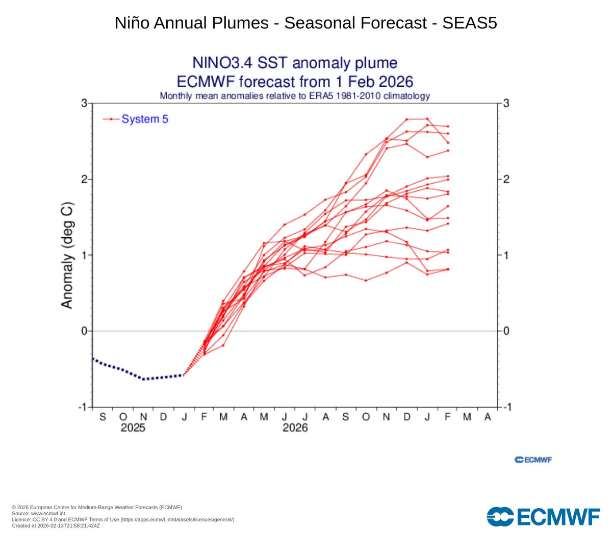
Photo: ECMWF
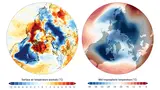
ENSO is forecast to enter the El Niño phase this year
An area of low air pressure will bring increased moisture from the Atlantic and Mediterranean, which will bring more precipitation to western, central and southern Europe.
Analyzes of temperatures in similar situations in the past show a tendency for a colder March in Europe in connection with the end of La Niña.
El Niño – Southern Oscillation (ENSO)
El Niño – Southern Oscillation (ENSO) is an irregular periodic phenomenon in the eastern region of the tropical Pacific, during which there is a change in sea surface temperatures and disruption of the Walker circulation, during which the trade winds may weaken or even reverse. This can have a significant impact not only on the regional, but also on the global climate. We determine the ENSO phase according to temperature anomalies (warmer or colder) in the area between 120° and 180° west longitude.
El Niño is the warm phase of ENSO that occurs when surface waters in the equatorial Pacific Ocean warm significantly. In addition, the equatorial winds push warm water towards the east, i.e. in the opposite direction than usual. This phenomenon disrupts normal atmospheric circulation patterns, which can have global effects on weather. During El Niño, heavy rainfall occurs in some areas (eg South America) and drought in others (eg Australia and Southeast Asia). The phenomenon appears approximately every 2–7 years.
La Niña is the cold phase of ENSO, which is the opposite of El Niño. It causes cooling of the surface waters in the equatorial part of the Pacific Ocean, and the equatorial winds push the warm water, on the contrary, more strongly towards the west. This phenomenon reinforces normal atmospheric circulation patterns, which also leads to global weather impacts. La Niña causes drought in South America, while in Australia, Southeast Asia and other regions it brings intense rains and floods.
It won’t be so strange, because the end of winter will be good in terms of temperature – especially in Western and Central Europe, the end of February will be accompanied by very above-average temperatures that can rise up to 20 °C.
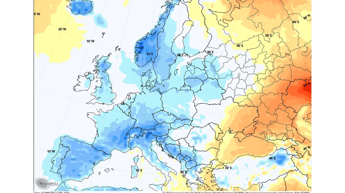
Big frosts are no longer expected in March. The combination of colder air and increased precipitation will have an effect on the possibility of snowfall at the beginning of spring, which may still surprise the northern, central and eastern parts of Europe.
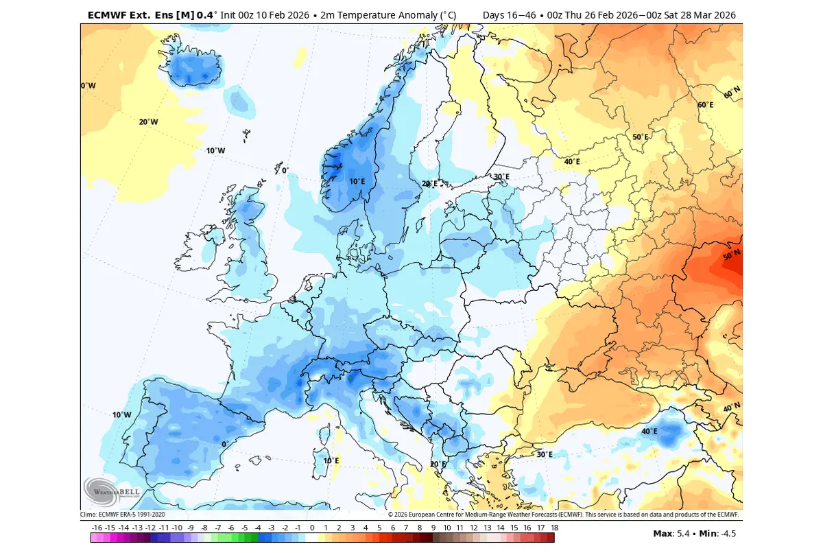
Photo: north-weather.eu/ECMWF
March should still be cold in Europe thanks to the influence of La Niña
Although the start of spring can be expected to be rather cold, as a whole this period should be around normal, or rather slightly above normal, according to model estimates. Especially in the southern parts of Europe.
However, the distribution of pressure formations could remain similar to March in April and May, so colder air may still penetrate into Europe and temperatures may drop to below-average values for short periods.
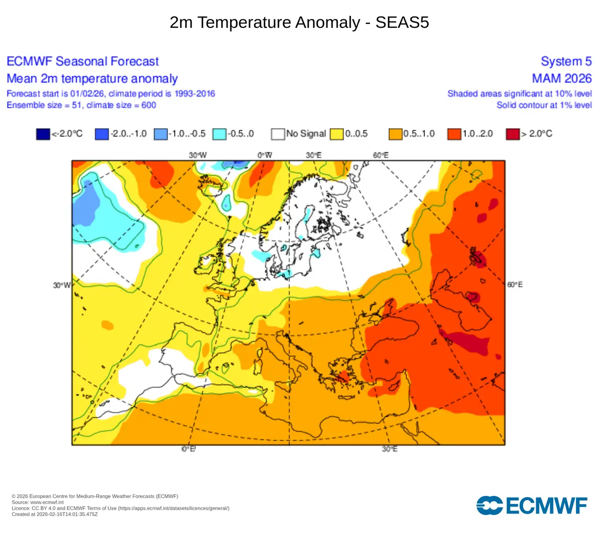
Photo: ECMWF
According to the long-term forecast, it should be spring with slightly above-average temperatures
Spring could be quite rich in precipitation, or at least it should not be dry. The reason is again the expected influence of the prevailing low air pressure over Europe and the influx of moist air from the Atlantic.